UN
32 Cambridge Road
£ 245,000
Description
We don't have a Description for this property.
- Bedrooms
- 2
- Bathrooms
- 0


Leaflet © OpenStreetMap contributors
The heatmap indicates the level of crime in the area. The color of the heatmap indicates the crime severity and recency.
Metrics Year-on-Year
- Average area value
- 224,000.00 £Decreased by 29.61 %
- Average area rental value
- 1,116.00 £/moDecreased by 12.40 %
- Est rental Yield
- 5.98 %Increased by 24.58 %
- Crime Rate
- 17.00 %Unchanged by 0.00 %
from 318,229.00 £
from 1,274.00 £/mo
from 4.80 %
from 17.00 %
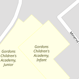
Nearby Schools
| Name | Type | Ofsted | Distance |
|---|---|---|---|
| Gordons Children'S Academy, Junior | Academy Sponsor Led | Good | 0.22 KM |
| Gordons Children'S Academy, Infant | Academy Sponsor Led | Good | 0.22 KM |
| St Nicholas Church Of England Voluntary Controlled Infant School | Voluntary Controlled School | Outstanding | 0.41 KM |
| All Faiths Children'S Academy | Academy Converter | Good | 0.52 KM |
| Gun Lane Children'S Centre | Children's Centre | 0.53 KM |
Images
Nearby Streets
| Name | Average Price | Average Sqft | Distance |
|---|---|---|---|
| Kaler Mews | £ 0 | 0 | 0.00 KM |
| Edward Street | £ 0 | 0 | 0.00 KM |
| Taylor's Lane | £ 0 | 0 | 0.00 KM |
| Cedar Road; Hawthorn Road | £ 300,000 | 0 | 0.00 KM |
| Ash Road | £ 0 | 0 | 0.00 KM |
Nearby Transport
| Name | NLC | TLC | Distance |
|---|---|---|---|
| Strood (Kent) | 5191 | SOO | 1.25 KM |
| Rochester | 5203 | RTR | 2.82 KM |
| Higham | 5202 | HGM | 3.90 KM |
| Chatham | 5199 | CTM | 4.14 KM |
| Cuxton | 5201 | CUX | 4.25 KM |
Nearby Listings
| Address | Price | Type | Score | Distance |
|---|---|---|---|---|
| Gordon Road, Rochester, Kent, ME2 | £ 240,000 | BUY | 7 / 10 | 0.05 KM |
| Gordon Road, Strood | £ 260,000 | BUY | 6 / 10 | 0.05 KM |
| Cambridge Road, Strood, Rochester, Kent. ME2 | £ 175,000 | BUY | Unknown | 0.07 KM |
| Gordon Road, Strood, Rochester, ME2 3HL | £ 300,000 | BUY | Unknown | 0.11 KM |
| Jersey Road, Strood, Rochester, ME2 | £ 280,000 | BUY | 5 / 10 | 0.12 KM |
Nearby Properties
| Address | Price | Distance |
|---|---|---|
| 19 Cambridge Road | £ 142,000 | 0.00 KM |
| 8 Cambridge Road | £ 37,000 | 0.00 KM |
| 34 Cambridge Road | £ 150,000 | 0.00 KM |
| 44 Cambridge Road | £ 142,500 | 0.00 KM |
| 13 Cambridge Road | £ 137,500 | 0.00 KM |